
 atisusanti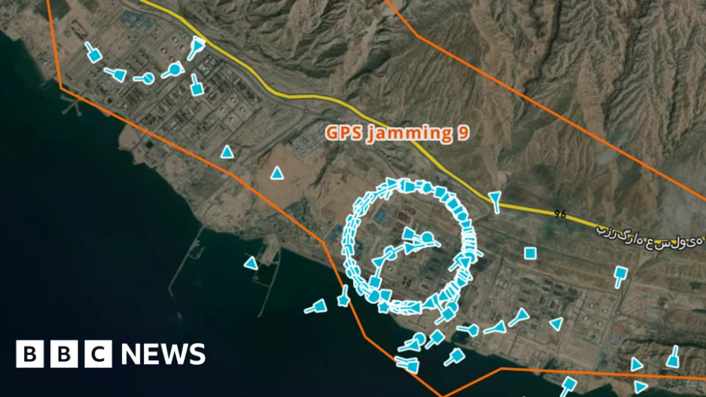
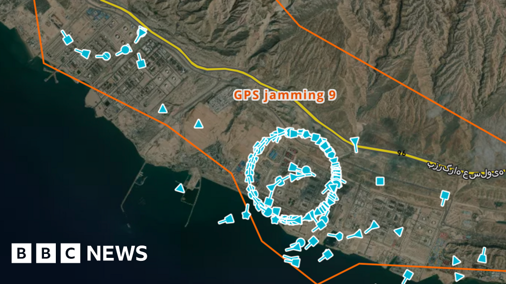
Hundreds, if not thousands, of ships are broadcasting their positions, but they are all in the wrong place. "Oh my goodness," exclaims Michelle Wiese Bockmann, senior maritime intelligence analyst at Windward, a maritime AI company, as she scrutinizes the live positions broadcast by commercial vessels in the waters off Iran, the United Arab Emirates, and Qatar. She counts "up to… 35 different clusters" as she examines a map encompassing the Strait of Hormuz and its surrounding regions. These clusters, peculiar circular formations of icons overlaid on the map, each represent a real vessel. However, ships do not naturally congregate in such tightly packed, unnaturally perfect circles. Moreover, they certainly do not appear to hover over land, which is precisely where some of these clusters materialize. Their GPS coordinates have been deliberately disrupted, rendering their true locations obscured.
The battlefields of modern conflict are no longer confined to the physical realm of bullets and bombs; they extend into the invisible spectrum of electromagnetic waves. GPS jamming, imperceptible to the naked eye, can unleash significant disruption, cripple communications, and, in the worst-case scenarios, lead to catastrophic accidents. In recent years, instances of GPS jamming have affected aircraft across Europe, including a plane utilized by the President of the European Commission. Furthermore, it has become a daily reality in the ongoing conflict in Ukraine. Now, as hostilities have escalated in the Middle East, the domain of electronic warfare is expanding its reach across even more territories.
The interference currently plaguing ships in and around the Strait of Hormuz is far from the first time Bockmann has witnessed GPS jamming compromising vessels’ Automatic Identification Systems (AIS). "We cannot over-estimate the immense danger this poses to maritime navigation and safety," Bockmann emphasizes. The National Hydrographic Office of Pakistan has also issued warnings regarding interference affecting shipping in the region. Ships rely on AIS, in part, to maintain safe distances from one another. A colossal tanker, stretching 300 meters and carrying hundreds of thousands of tonnes of oil, requires a considerable amount of time to alter its course or come to a complete stop. Vessels can potentially travel many kilometers before their trajectories are fully adjusted. The inability to ascertain the precise locations of nearby vessels drastically elevates the risk of a collision, particularly during periods of darkness or poor visibility. "That’s the problem," explains Alan Woodward from the University of Surrey. "It’s not about you knowing where you are going – it’s about not knowing where everyone else is going."
While there has been no official confirmation regarding the perpetrators of this jamming, military analysts strongly suspect Iran of orchestrating the disruption to vessels. Iran has also issued threats to attack any ship attempting to transit the Strait of Hormuz. According to Thomas Withington, an associate fellow at the Royal United Services Institute, a think tank, the Global Navigation Satellite System (GNSS) or GPS jamming tools employed by Iran are likely to be domestically produced or manufactured using equipment sourced from Russia or China. He further suggests that US forces operating in the region may be utilizing jamming systems to safeguard their bases, personnel, and vessels from drones and GNSS-guided weaponry. When contacted, the US Department of War responded to the BBC by stating, "Due to operations security, we are not going to comment on the status of specific capabilities in the region."
Sean Gorman, co-founder of the tech company Zephr.xyz, which has meticulously analyzed the extent of GPS jamming in various countries, including Ukraine, notes that while aircraft data can reveal instances of jamming, the current closure of Iranian airspace has necessitated the exploration of alternative data sources. In recent days, Gorman leveraged radar data from a satellite to detect jamming activities in Iran. Although the BBC has not independently verified this data, Gorman asserts that jamming devices leave a discernible trace of interference within radar signals, thereby enabling the identification of GPS-jamming occurrences across the country. In 2024, Gorman and his colleagues employed smartphones attached to drones to study GPS jamming in Ukraine. As these drones navigated various locations, the smartphones recorded GNSS information, capturing instances of interference that could then be mapped. "We were looking at the [GNSS] measurements of all those phones," Gorman elaborates. "You could triangulate to where the jammer was located." He expressed his astonishment at "the level of jamming and how powerful it is."

A variety of technologies are emerging to offer protection against GPS jamming. Mitigating this problem can involve the automatic detection of jamming or interference, followed by a seamless switch to unaffected frequencies. For instance, defense giant Raytheon manufactures a device named Landshield, which, in its smallest configuration, is comparable in size to an ice hockey puck. The company states that this "anti-jam antenna system" can be integrated into a wide array of vehicles, from cars to aircraft, and utilizes multiple channels to circumvent jamming. "We’re seeing quite an increase in demand and capacity for our anti-jamming products at the moment," remarks Alex Rose-Parfitt, engineering director at Raytheon UK.
Other companies are developing navigation tools that circumvent the inherent vulnerabilities of GPS. Advanced Navigation, an Australian-based firm, has devised a system capable of determining a vehicle’s position based on readings from gyroscopes and accelerometers – similar to the sensors in a smartphone that detect orientation changes. Chris Shaw, co-founder and chief executive of Advanced Navigation, explains that when GPS becomes unavailable or unreliable, his firm’s technology can ascertain a vehicle’s geographic position through alternative means. These alternatives include matching optical imagery of a location with satellite imagery or employing computer-based analysis of the celestial positions of stars overhead. "The image processing is very advanced," Shaw notes. "Doing something like… star-mapping is very inexpensive." However, he candidly admits, "It’s just not very accurate." Consequently, a combination of multiple location and position analysis methods may be required.

Without enhanced protective measures, GPS is likely to remain susceptible in its current form. Crucially, the signals utilized by GPS-based systems are exceptionally weak, making them inherently easy to jam. It is pertinent to note that military forces have access to "M-Code" GPS, a highly authenticated and encrypted version of the technology that exhibits significantly greater resistance to jamming. Ramsey Faragher, director of the Royal Institute for Navigation, highlights that GPS jamming in the waters off Iran escalates the risk of maritime accidents. He predicts that the increasing prevalence of jamming could spur the adoption of more secure alternatives. This trend mirrors the gradual transition from entirely open and publicly accessible Wi-Fi networks to the password-protected networks common today. "Soon, we will look back on this era where we are using open GNSS signals and think, ‘God, we were mad, that was really not a smart move’," he concludes.



 Nana Banana

 Ramos Leo