
 Nana Banana
As the day progresses, these torrential downpours are anticipated to gradually shift southwards and eastwards, impacting other regions of Wales, the Midlands, East Anglia, and southern England. Motorists are being specifically cautioned about the transition back to wet weather, which could create treacherous driving conditions due to reduced grip and the heightened risk of roads becoming submerged. Accompanying this shift in weather, temperatures are also forecast to decline, with many areas expected to experience conditions below the seasonal average for August over the coming days.
Low Pressure Drifts Eastwards, Ushering in Unstable Weather
After a summer largely characterised by persistent high-pressure systems, which brought prolonged periods of sunshine and exceptionally dry conditions, a low-pressure system has now firmly established its dominance over the UK. This change in atmospheric pressure is the primary driver behind the current unsettled weather. The presence of unstable air within this low-pressure system provides the perfect conditions for the development of towering storm clouds, known as cumulonimbus clouds. These clouds are capable of unleashing torrential downpours, often accompanied by hail, lightning, and thunder.
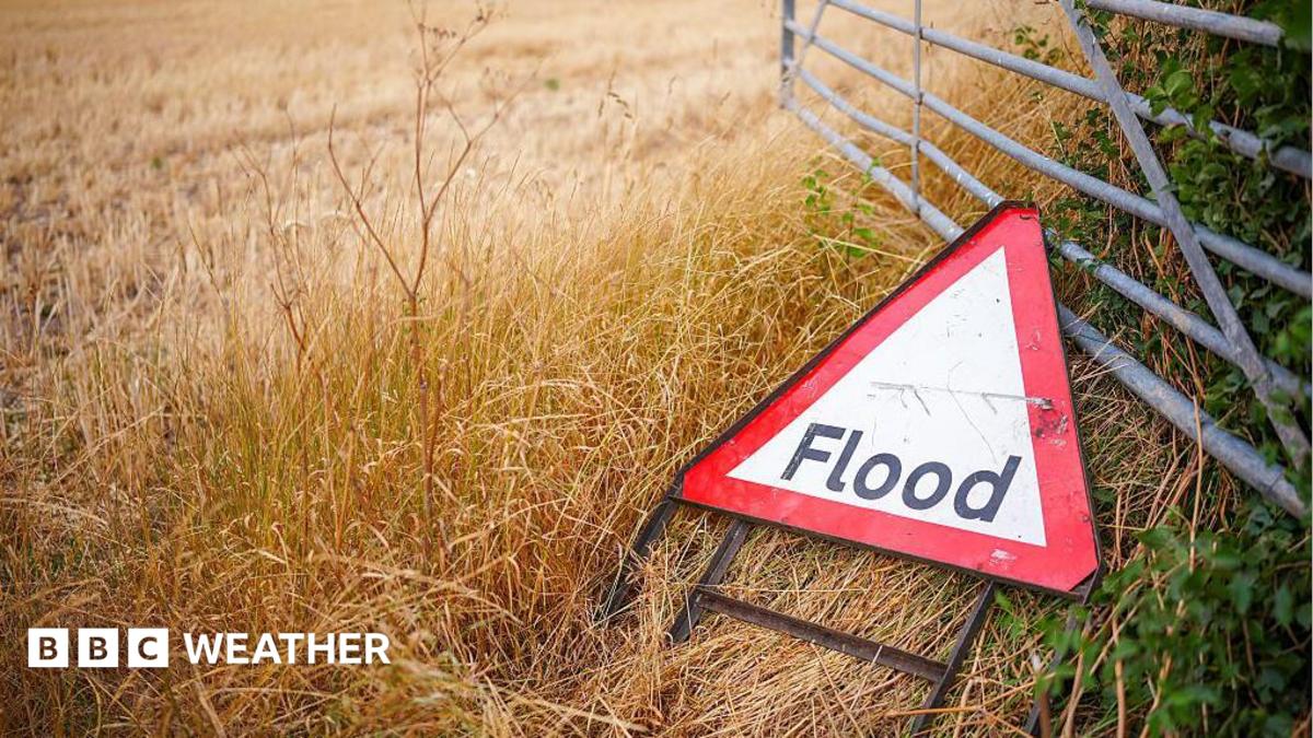
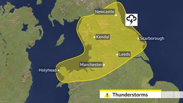
Throughout Thursday morning, the regions of northern England and north Wales are expected to bear the brunt of these intense thunderstorms. Within the Met Office’s yellow warning area, there is a distinct possibility of rainfall accumulations reaching 15-20mm in as little as an hour, with larger totals of 30-50mm potentially falling over a six-hour period. Such concentrated rainfall significantly elevates the risk of flash flooding, particularly in areas where the ground remains exceptionally hard and baked after the recent prolonged hot and dry spell. This parched earth is less able to absorb water quickly, leading to rapid surface runoff that can overwhelm drainage systems and low-lying areas. The additional hazards of lightning strikes and hail are also anticipated, posing risks to outdoor activities and infrastructure.
Showers are forecast to gradually ease from the northern parts of the country during the morning, subsequently migrating southwards into other areas of Wales, as well as central and southern England. Here, while not all areas will be affected, some downpours could still be notably heavy and thundery. The localised nature of convective showers means that while some places may experience significant rainfall, nearby areas might remain relatively dry. Scotland and Northern Ireland are also expected to see showers, though these are generally projected to be less intense, with a lower probability of thunder and lightning.
Tricky Driving Conditions Demand Caution
Motoring experts have issued strong warnings about the dangerous driving conditions that often arise when wet weather follows an extended dry period. Rod Dennis, a road safety spokesperson for the RAC, highlighted the specific hazards: "Oil, fuel, and rubber deposits that have accumulated on road surfaces over many weeks will now have been mixed together by the initial light rain. Instead of being washed away, this creates a greasy film, meaning drivers face a significantly greater risk of skidding." He further elaborated, "If heavier rain arrives, motorists may also have to contend with the immediate danger of flash floods in some areas, which can quickly make roads impassable or hide underlying hazards."
In response to these warnings, drivers are strongly advised to adopt a more cautious approach. This includes reducing their speed considerably and increasing the distance between their vehicle and the one in front to allow for greater braking distances. Maintaining sufficient tread on tyres and ensuring windscreen wipers are in good working order are also crucial for safety. Additionally, drivers should be prepared for reduced visibility due to spray and heavy rain, and consider delaying non-essential journeys if conditions become particularly severe. Public transport users should also anticipate potential delays and check service updates before travelling.
No Immediate End in Sight for the Drought
Despite the recent return of rain, experts are unanimous in warning that the severe drought conditions gripping large swathes of the UK will not be brought to an immediate end. The current rainfall, while locally heavy, is often characterised by short, intense bursts which tend to run off hard ground rather than steadily soaking into the soil to replenish groundwater supplies and larger reservoirs. A sustained period of consistent, moderate rainfall, spread over many weeks or even months, is required to genuinely alleviate the widespread hydrological drought. It is highly unlikely that the full extent of recovery will be known until late in the upcoming winter season, which is typically when the majority of groundwater recharge occurs.
It is important to understand that drought is a complex phenomenon, and its impacts extend far beyond just low river levels and reservoir stocks. Agricultural drought, affecting crop growth and livestock, has been a significant concern throughout the summer. Ecological systems have also been under severe stress, with increased risks of wildfires and impacts on wildlife. The widespread hosepipe bans introduced across many regions underscore the severity of the water deficit. However, it is also worth noting that while most areas across the UK have experienced rainfall well below their seasonal norms this summer – with some locations enduring a dry spell stretching for two months – this has not been universally the case. A notable exception is Aultbea in the Scottish Highlands, which has recorded an astonishing 389.6mm of rain so far this summer. This figure represents more than one and a half times its seasonal norm and is just 10.2mm short of its wettest summer on record, highlighting the significant regional variations in weather patterns across the country.
Temperatures Fall Below Average
As northerly winds begin to develop and dominate the atmospheric flow across the UK, temperatures are set to experience a noticeable drop. Thursday afternoon is expected to see daytime highs ranging from 13C in the coolest northern areas to around 23C in the warmest southern regions. This marks a significant change, as it is projected to be the first day since 29 June when temperatures will fail to reach 25C anywhere in the United Kingdom, effectively drawing a line under the recent heatwave conditions.
Friday is forecast to be even cooler, with temperatures widely remaining below the August average across the entire country. The August norm for daytime highs typically ranges from 15C in northern Scotland to around 23C in parts of southern England. Friday night will also usher in the chilliest conditions experienced for quite some time, with temperatures widely dropping into single digits across many areas. Parts of Scotland and northern England could even see lows of 3 or 4C, making for a distinctly autumnal feel. These chilly nights are expected to continue into the weekend, although daytime temperatures are predicted to rebound slightly as a ridge of high pressure attempts to build. This building high pressure should lead to less widespread rain and a greater chance of sunshine for many, offering a brief respite from the unsettled conditions. Residents are encouraged to stay informed about their local forecast by checking the BBC Weather website and app for the latest updates and warnings.




 atisusanti
 George Anjay
 Nakalama John

 Ramos Leo