
 Nana Banana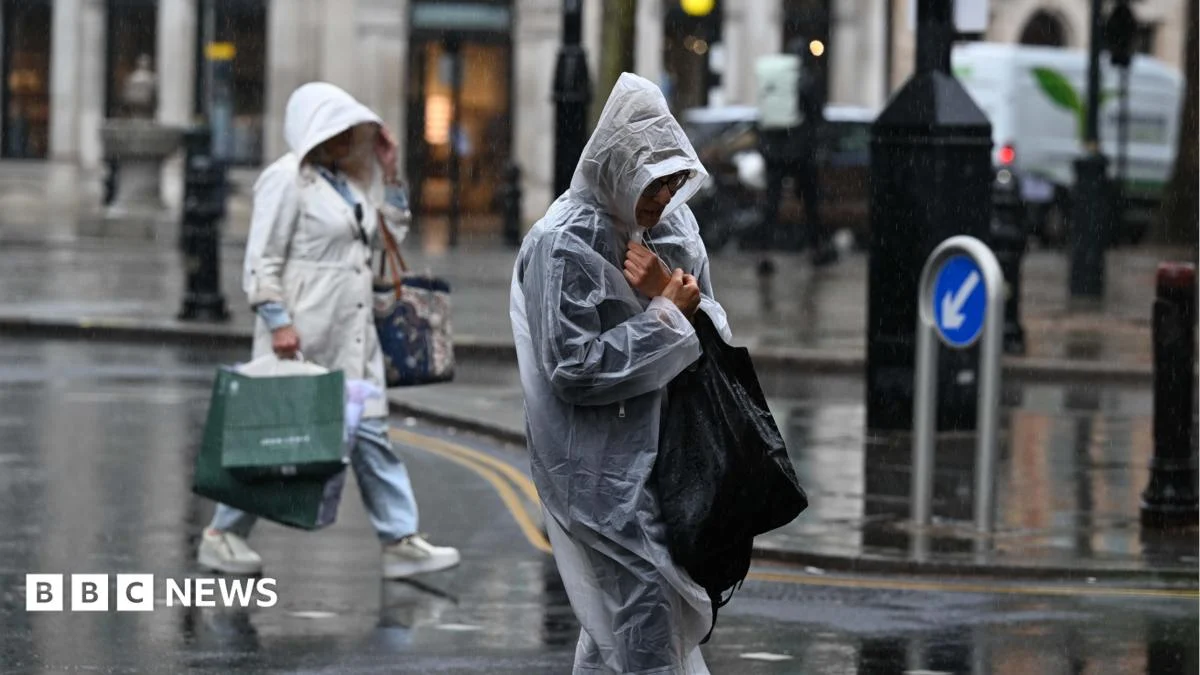
The latest meteorological models indicate that a complex low-pressure system, tracking in from the Atlantic, will interact with exceptionally warm and humid air currently lingering over the British Isles. This volatile mix is the perfect recipe for intense convective activity, leading to the development of numerous thunderstorms. Initially, areas in southern England and Wales are expected to bear the brunt of the activity, with storms developing rapidly from late afternoon onwards, carrying the risk of torrential downpours that could see 20-30mm of rain fall within an hour in localized spots, and potentially up to 50-60mm over a few hours in persistent storm cells. These figures represent a significant volume of water in a short space of time, drastically increasing the likelihood of surface water flooding.

As the system progresses, the threat will extend northwards, encompassing the Midlands, parts of Northern England, and eventually reaching Scotland and Northern Ireland by the weekend. While the exact timing and location of the most severe storms remain subject to short-term fluctuations, the general trend points towards widespread instability. Individual thunderstorms are notoriously difficult to predict with pinpoint accuracy hours in advance, but the overall environment is highly conducive to their formation. The storms will not necessarily be continuous, but rather intermittent, with periods of heavy rain and thunder interspersed with drier, brighter spells, giving a false sense of security before the next cell develops. Night-time thunderstorms, often more difficult to prepare for, are also a distinct possibility, particularly in the south.

The nature of these storms extends beyond mere heavy rainfall. Lightning activity is expected to be frequent and widespread, posing a risk to life and property, particularly for those outdoors or living in areas with older electrical infrastructure. Hail, potentially large enough to cause damage to vehicles and crops, is also a significant threat within the most vigorous cells. Furthermore, strong, localised wind gusts associated with downdraughts from collapsing storm clouds could bring down trees, damage temporary structures, and create hazardous driving conditions. The cumulative effect of multiple storm cells tracking over the same area could lead to more prolonged periods of intense rainfall, saturating the ground and increasing the risk of river and stream levels rising rapidly, even if they don’t directly overflow.

The potential impacts of this extended period of unsettled weather are considerable and far-reaching. Travel networks are likely to experience significant disruption. Roads could become quickly impassable due to flash flooding, particularly underpasses and low-lying routes. Visibility will be severely reduced during intense downpours, making driving extremely hazardous. Public transport, including rail services, may face delays or cancellations due to track flooding, lightning strikes affecting signalling equipment, or debris on the lines. Air travel could also be affected, with potential for flight delays or diversions as storms pass over major airports. Commuters are advised to check local travel updates before embarking on their journeys and to allow extra time.

Beyond transport, there are concerns for infrastructure and public safety. Power cuts are a common consequence of severe thunderstorms, with lightning strikes capable of damaging power lines and substations. Telecommunication services may also be affected. For homeowners and businesses, the risk of property damage from localised flooding, water ingress, or falling trees is elevated. Basements and ground-floor properties in vulnerable areas are particularly at risk. Emergency services are preparing for an increase in calls related to flooding, road incidents, and other storm-related emergencies. Outdoor events and activities planned for the coming days should be carefully reviewed, with organisers urged to consider the safety of participants and spectators. Farmers, already contending with variable conditions, will be monitoring the forecast closely, as heavy rain and hail can severely impact crop yields and livestock.

In response to the developing situation, the Met Office has been proactive in issuing detailed weather warnings. A Yellow warning for thunderstorms indicates that there is a good chance of impacts such as travel disruption, some flooding of homes and businesses, and power cuts. An Amber warning signifies a higher likelihood of more significant impacts, including extensive disruption, potential for significant flooding, and a greater risk to life and property. The public is strongly advised to pay close attention to these warnings and to act accordingly. Practical advice includes securing loose garden furniture, checking drains and gutters for blockages, and ensuring mobile phones are charged in case of power outages. During a storm, it is crucial to stay indoors and avoid unnecessary travel. If driving, be prepared for sudden changes in conditions and never drive through floodwaters, as their depth and current can be deceptively dangerous. Unplugging non-essential electrical appliances can help protect them from power surges caused by lightning.

From a meteorological perspective, the current setup is a classic example of an unstable atmosphere. Warm, moist air, often originating from continental Europe or the Bay of Biscay, rises rapidly when confronted with a cooler air mass or a trigger mechanism like a frontal boundary or convergence zone. As this warm, humid air ascends, it cools and condenses, forming towering cumulonimbus clouds – the quintessential thundercloud. The energy released during this condensation process, coupled with strong vertical wind shear, fuels the intense updraughts and downdraughts characteristic of thunderstorms. The slow movement of the overarching low-pressure system means that some areas could experience repeated downpours, leading to higher accumulated rainfall totals over several days. This contrasts with more organised frontal rain, which tends to be less intense but more prolonged over wider areas.

Expert commentary underscores the need for vigilance. "We’re looking at a multi-day threat here, not just an isolated event," explains Dr. Eleanor Vance, a senior meteorologist at the Met Office. "The challenge with thunderstorms is their localised nature; one area might see torrential rain and hail, while a few miles away it remains dry. This makes precise forecasting difficult, but the overall risk is high across broad swathes of the UK. We urge everyone to stay informed through official channels, check our warnings regularly, and have a plan in place." Emergency services echoes this sentiment. "Our teams are on standby," states Chief Inspector Mark Davies of the National Resilience Centre. "The key message is preparation and common sense. Do not take risks. If you encounter flooded roads, turn back. If you lose power, check on vulnerable neighbours. We are here to help, but prevention and caution are always the best first steps."

Looking ahead, while the immediate threat is focused on the coming days, the longer-term outlook suggests a continuation of unsettled conditions for much of the UK into the early part of next week, albeit potentially with a slight reduction in the intensity or frequency of thunderstorms in some areas. However, the pattern of low pressure and frontal systems looks set to persist, meaning that further periods of rain and wind are likely, preventing a return to prolonged dry, settled weather for the foreseeable future. This prolonged period of instability could also lead to saturated ground conditions, meaning subsequent rainfall, even if not as intense, could still pose a flooding risk. The British public is therefore advised to remain aware of the changing weather picture and continue to monitor forecasts closely as the UK navigates this notably unsettled spell.



 atisusanti
 George Anjay
 Nakalama John

 Ramos Leo